Severe weather threat gives way to much-needed rain
The National Weather Service cancelled severe weather watch alerts throughout central North Carolina Monday night, but rain and lightning were expected to continue through the night.
Posted — Updated
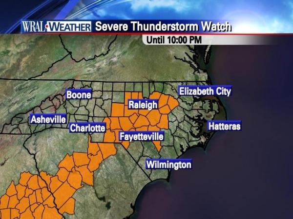
A band of storms in the western part of North Carolina moved slowly through the east Monday evening, bringing with it a chance of severe weather, including the potential for damaging winds.
Wind gusts reached up to 45 mph at times.
There were some reports from WRAL.com visitors of minor storm damage in the Triangle by 7 p.m., including a tree down at Optimist Farm Road and Sunset Lake Road in Holly Springs and a tree struck by lightning on Dumont Drive in Hillsborough.
There were also reports of hail in Apex and power outages in south Raleigh blamed on weather.
In Willow Springs, there were reports of a telephone pole struck by lightning knocking out service to some homes in the 8200 block of Mount Pleasant Church Road.
The rest of the week looks clear and cooler with highs on Tuesday expected around 60 degrees and Wednesday in the upper 60s.

• Credits
Copyright 2024 by Capitol Broadcasting Company. All rights reserved. This material may not be published, broadcast, rewritten or redistributed.


