Snow and ice to start week
How two storms developing in the Southwest and Northwest interact with each other will determine how much snow and ice central North Carolina will see Monday and Tuesday.
Posted — UpdatedWRAL meteorologist Kim Deaner said a storm developing in the southern jetstream will bring a great deal of moisture to the area by Monday, but a competing storm developing in the northern jetstream will bring dry air, possibly counteracting the expected precipitation.
As of Saturday night, a winter weather watch for Monday was in effect in 68 counties.
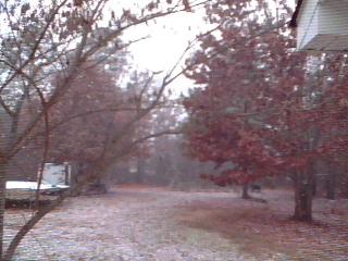
Snow flurries fell across central North Carolina midday Saturday and high temperatures reached the low 40s.
Sunday was expected to be colder and dry, with highs in the upper 30s.
While snow is in the forecast for Monday, WRAL Chief Meteorologist Greg Fishel quashed hopes for significant accumulation.
"I see no way that this system could be comparable to what we had at Christmas," he said Friday. "Get that out of your mind."
A bitterly cold weekend sets up the atmosphere for dry air to move into the Carolinas from the south and west.
Fishel predicted light snow would begin to fall late Monday.
It will quickly transition to freezing rain Monday night and end as drizzle Tuesday morning, WRAL meteorologist Mike Maze said.
Monday's temperatures won't get much above the freezing mark, so rain, sleet and ice could make Tuesday's travel a challenge.
"We won't see a snowy impact," Maze said, "but could see more of an icy impact."
That is a worry for Drew Elliot of Progress Energy. Ice can weigh down power lines leaving customers in the dark and cold. "An eighth of an inch – that's worse than six inches of snow in some cases," he said.
The construction crew of Madison Renovations planned a working weekend so they do not lose days of work should the snow and ice fall.
"We're going to work Saturday because we may not be able to work Monday or Tuesday," said William Madison. "It just backs everything up."
In Wake County, the Department of Transportation was already looking ahead to the next chance for precipitation. Steve Abbott said crews would wait until any rain from Friday had dried, but then planned to spread brine to prevent ice from building up on roads.
Elliot's utility team was also in wait-and-see mode. If the power goes out, they spring into action.
"Generally, in winter storms, we can be restoring power even as the storm is on going. So that lets us keep ahead of the storm a little bit," he said.
• Credits
Copyright 2024 by Capitol Broadcasting Company. All rights reserved. This material may not be published, broadcast, rewritten or redistributed.


