Rain, Lower Temps on Tap Thursday
North Carolina could see a mixed bag of weather Thursday with rain and strong winds in the morning, followed by a sharp drop in temperatures. Plus, there's the possibility of snow showers in the far western counties.
Posted — Updated
A storm system made its way east from Tennessee into the mountains of North Carolina overnight Wednesday and will continue across the state Thursday. The storm system was expected to bring isolated thunderstorms.
The severe weather created traffic problems throughout the Triangle. Chapel Hill's Horace Williams Airport reported heavy rain at times during the morning rush hour. Almost one-half inch of rain was reported at the airport.
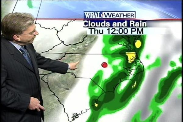
As of noon, Raleigh has picked up more than one-quarter inch of rain at the Raleigh-Durham International Airport. Little additional rain is expected.
Accompanying the rain will be a sharp drop in temperatures. Readings that are expected to start out in the low 60s Thursday morning will plummet to the high 40s during the day as the front passes through the Triangle.
Winds also will be brisk, gusting up to 35 mph Thursday.
The same system was responsible for severe weather in Tennessee and Kentucky late Wednesday evening, knocking down trees and power lines.
All the rain should end by around lunchtime Thursday. Once the cold front is done stirring up things, daytime highs through Monday will be in the 50s, with lows in the 30s.
When the WRAL-TV Raleigh Christmas Parade starts at 9:30 a.m. Saturday, the temperature will be in the upper 30s.


• Credits
Copyright 2024 by Capitol Broadcasting Company. All rights reserved. This material may not be published, broadcast, rewritten or redistributed.


