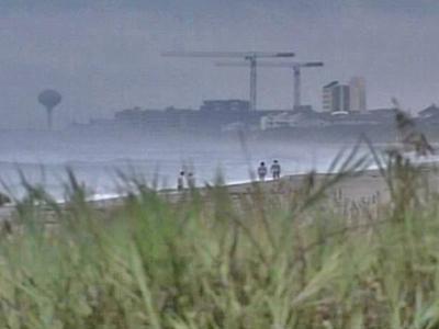
'Fickle' Gabrielle Dumps Rain On Coast, Bids N.C. Farewell
Tropical Storm Gabrielle became a major rain event for North Carolina's coast. All warnings were lifted as the storm moved out to sea late Sunday night.
Posted — UpdatedGabrielle turned to the east and was back over the Atlantic Ocean by 11 p.m. Forecasters expected the storm to be far out to sea by Monday afternoon.
"(It's) been one of the most unpredictable storms that I have ever seen. In fact, it kept reorienting itself in a fashion that it appeared that it would never give any part of North Carolina any significant rain," WRAL's Chief Meteorologist Greg Fishel said.
"That was the case until late this afternoon. ... The system ... certainly has made a splash, literally, along parts of the North Carolina coast," he continued.
The storm's center was located near latitude 36.3 degrees north and longitude 75.3 degrees west, about 75 miles north of Cape Hatteras.
A storm surge of 2 to 3 feet along the Outer Banks was expected to subside overnight, the NWS said.
Gabrielle made landfall at Cape Lookout just before noon and during the afternoon and early evening, brought its worst effect - heavy rainfall - to the Crystal Coast, particularly in Carteret County and parts of Craven County.
"Boy, there has been some amazing rainfall down across parts of the southern coast of North Carolina," Fishel said. "It's been a very wet time of it down around Morehead City on down to Cape Lookout."
Morehead City reported a confirmed rain total of 5 inches, but radar estimates indicate some areas may have gotten over 6 inches. Atlantic Beach saw 4 inches of rain, while as of 6 p.m., 5 inches of rain had fallen on the ocean off Cape Lookout. The Associated Press reported nearly 5 inches of rain in Harlow.
Local emergency management officials said their worst worry from all that rain was sound-side flooding.
Around 9 p.m., reports came in of water from the Pamlico Sound covering portions of N.C. Highway 12, the major artery for the Outer Banks, around Salvo. Atlantic Beach, Beaufort and Morehead City saw plenty minor street flooding Sunday night.
In other areas, Gabrielle was mostly a tease.
In Wrightsville Beach and the rest of New Hanover County, clouds gathered and rain fell, but barely enough to form puddles in the roads on Sunday afternoon. New Bern saw an inch of rain, The AP reported.
"This has given us a little practice run for hurricanes," Currituck County spokeswoman Diane Sawyer said. "You don't wish to have a storm, but if you have to have one, it's a good one to have. It looks like we're going to be lucky."
The lack of rain in the central portion of the state disappointed Triangle residents who, earlier this week, hoped to see the tropical storm bring relief from extreme drought.
"Around this part of the state, there was little effect to be found from the tropical system," Fishel said.
"About the only thing I can say is that usually on the outer periphery or edges of a tropical system, you tend to get sinking air, and it becomes very, very warm and very dry. And we certainly saw that today," he continued.
"We just saw a few harmless clouds in our part of the state," he added.
Richard Willis, who was vacationing in Atlantic Beach, said he hoped some of the rain would make its way back to his hometown of Raleigh.
"We certainly are dry in Raleigh. I was hoping we'd get some of it," he said. "I'm afraid we won't."
Gabrielle deposited less rain than expected on land, because the storm's thunderstorm activity shifted mainly to south and east of its center of rotation on Sunday.
"This has been a strange storm from day one, in the sense that over the last few days, the distribution of rainfall around this system has not been symmetrical by any stretch of the imagination," Fishel said. "For yesterday, most of the activity's been northwest of the center. Today, it's been south."
"It's been the most unpredictable and fickle storm," he added.
Maximum winds decreased to 45 mph, but higher gusts continued including ones of 52 mph at Frisco Pier and Cape Hatteras. Around 9:30 p.m. Sunday, sustained winds were at 31 mph at Cape Hatteras and 12 mph at Kill Devil Hills. Winds were calm inland at Washington, N.C.
Four coastal ferry routes were temporarily suspended: Cape Hatteras to Ocracoke, Ocracoke to Swan Quarter, Ocracoke to Cedar Island and Currituck to Knotts Island. The routes were expected to be reopened on Monday, but officials said that could be moved up, depending on how quickly the storm moved through the area.
Dare County officials said their fears of beach erosion had eased as they watched the actual effects of the storm on Sunday. Likewise, officials reported no serious erosion in Surf City, Topsail and North Topsail, beaches which usually take a beating during Atlantic storms.
Gov. Mike Easley put National Guard and swift-water rescue units on standby and Department of Transportation recovery crews in place in coastal areas of North Carolina with the storm's arrival Sunday. The state’s Emergency Operations Center was activated late Friday and monitored the storm.
• Credits
Copyright 2024 by WRAL.com and the Associated Press. All rights reserved. This material may not be published, broadcast, rewritten or redistributed.


