
The last weekend of 2008 turned out to be a warm one, with high temperatures at the RDU airport reaching 59 degrees Saturday and 74 degrees (tying a previous record reached in 1984 and 1988) on Sunday, both well above the normal high of 51. A weak cold front that crossed the area last night will leave us cooler and less humid later today and tomorrow, but we'll actually remain above normal on the temperature scale.
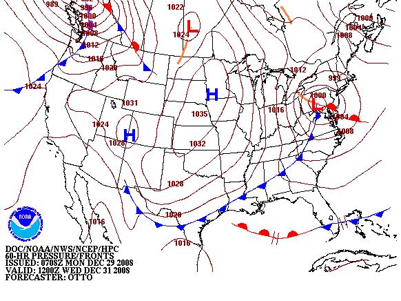
That should change a bit around mid-week, though, as what looks to be a dry, reinforcing cold front (shown on the attached map from the NWS Hydrometeorological Prediction Center) passes through the area Wednesday. Behind that front, temperatures will take a sharper fall, with highs in the low to mid 50s Wednesday and 40s despite sunshine on New Year's Day. Thursday's high looks really chilly in the context of the warm weather we've seen of late, but will only be a little below the January 1st normal high of 50 degrees.
If you're heading to an outdoor New Year's Eve celebration like First Night in Raleigh, it appears very unlikely you'll have to deal with any precipitation, as skies will likely be clear or mostly so. We will have colder temperatures than many recent nights, though, as the temperature should fall into the mid or upper 30s by midnight, heading for upper 20s and low 30s by Thursday morning. We're likely to have stiff northwest winds Wednesday afternoon and into the evening as well, so it may feel a little colder than the actual temperature. Bundle up accordingly, have fun, and Happy New Year!
Copyright 2024 by Capitol Broadcasting Company. All rights reserved. This material may not be published, broadcast, rewritten or redistributed.


