
By Mike Moss
A very common question over the past couple of weeks has been "how much do our area lake and reservoir levels rise for a given amount of rainfall?" In particular, how much would they rise for each inch of rain? It would be nice if there was such a straightforward relationship, but while I've checked around quite a bit with area water managers, weather personnel, and hydrologists, the response of lake levels to rainfall inputs involves a lot of complicating factors that prevent us from reducing it to a simple and dependable rule of thumb. Even if we assumed a uniform rainfall of one inch across the entire watershed that feeds a given lake, we then run into the following questions (and probably more that I'm not thinking of):
At what rate did the rain fall? The response to one inch in a half hour may be quite different from one inch spread over two days, for example.
How dry was the soil, what is the character of the soil and underlying bedrock, and what was the state of vegetation? If vegetation is active some water will be taken up by root systems, utilized by the plants and then transpired to the atmosphere. If the soil is very dry and hardened that may increase runoff rates - likewise if the soil is highly saturated due to recent rains that may enhance runoff rates as well. On the other hand, soil that is quite dry but not hardened at the surface may allow a large amount of percolation that substantially reduces runoff rates and the resulting collection of streamwaters flowing into downstream lakes. The rate at which this occurs also varies from place to place depending on the particulars of the soil type and land use patterns (urban, rural, forested, cropland, etc).
How dry, how windy and what temperature is the atmosphere in the wake of the rainfall? This can impact how much of the water running off toward streams and tributaries is lost to evaporation.
Are there controls on the flow of water along the way to the major lakes in the form of smaller impoundments, and how are those controls managed? For instance, a part of the upper Neuse River watershed feeds not only Falls Lake, but upstream bodies of water at the Little River Reservoir and Lake Michie, and the status of those will affect flow into Falls Lake.
At what rate is water being removed from the lakes for drinking, industry and general use, along with downstream outflow used to maintain river levels beyond the lake? This will offset inflow to a degree that depends on water demands, which varies by time of year, temperature and conservation measures that are in use.
What is the size and topography of the watershed that drains into the lake? Falls Lake, for example, taps an upstream watershed that covers 770 square miles, whereas the Jordan Lake drainage area is 1680 square miles and drainage into Kerr Lake comes from 7800 square miles.
Finally, of course there is the fact that rainfall usually isn't in reality widespread and uniform but is often unevenly distributed in bands, clusters and streaks that further complicate the picture.
One of our web visitors wrote that he heard on the radio that that 1.5 inches of rain will produce a one inch lake level rise. This struck me as probably more applicable to rain that falls directly onto the lake surface rather than rain that falls across a watershed and gets concentrated as it collects in the lake. For example, if you imagine a lake with perfectly vertical sides (like a pool), a uniform rainfall of one inch across the lake surface (with no runoff from elsewhere) would raise the lake surface one inch (discounting any evaporation, drawdown or downstream outflow). Since the lakes actually have sloping sides, it would take more than one inch of rain into our idealized lake to raise the level one inch, but how much more would depend on the particular shape of the lake and it's overall size.
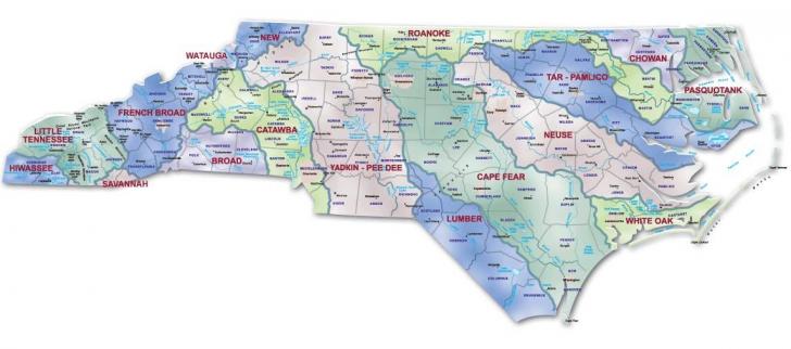
So, given all that, how did area lakes respond to the recent rainfall event? While we don't have all the pertinent data on upstream flow controls, evaporation rates, water demand and the like, we can at least take a rough look at how much rain fell over about a three and a half day period and how it was distributed with respect to the basins supplying area lakes. The first image I've included is a map of NC River basins that will give you a sense of where rain has to fall to impact each reservoir. You can explore it in much more detail at
http://www.eenorthcarolina.org/public/ecoaddress/riverbasins/riverbasinmapinteractive.htm
With this map as a comparison point, we can next look over an estimate of rainfall totals that mainly include the rains that fell from 23-27 October across the region. This map is from the NWS Precipitation Analysis site. You'll see that across the basin that feeds Falls Lake (along with some upstream impoundments, remember) a reasonable average rainfall across the basin is about 4 inches, maybe a little more. On the other hand, the watershed for the Haw and Cape Fear, feeding into Jordan Lake, and the western Roanoke Basin, where the Dan and Banister Rivers collect water headed for Kerr Lake, both extend into an area that averaged somewhat greater totals, and recall these lakes also tap much larger drainage areas. The average rain over these basins was probably 5-6 inches, with some pockets that may have been even higher.
The response of the lakes over the time since the rain event shows a definite uptick in levels, but the amount differs greatly between Falls and the other two. The three graphs showing Falls, Jordan and Kerr lakes (available through the "Almanac" link on our main weather page) shows that Falls rose just under a foot (about 11 inches) before leveling off and starting to decline slightly. At Jordan, the rise was about 2.4 feet, most of that over a three or four day period, followed by a more gradual increase ever since. At Kerr, the increase followed a similar pattern to Jordan, but with a rise of just over 3 feet. One could reason that the larger rises and continued slow increase for the latter lakes is mainly a function of their larger watersheds, along with a little greater average rain into those headwaters.
Can we just divide the rises by the average rainfall to get a response rule of thumb? We could, but for all the reasons listed above the response to similar rainfall amounts at some other time could be very different. For this particular event, though, and given the particular antecedent conditions, we come up with the following ratios. For Falls Lake, we saw about a 2.6 inch rise for each inch of rain. For Jordan, the ratio was about 5.3 to 1, while for Kerr it ran about 6.8 to 1.
Copyright 2024 by Capitol Broadcasting Company. All rights reserved. This material may not be published, broadcast, rewritten or redistributed.


