
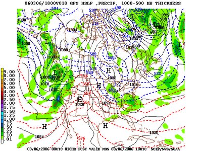
After a very pleasant weekend with lots of sun, chilly mornings and seasonably cool afternoons, we're kicking off the week with a passing low pressure wave that is producing at least some measurable precipitation across the region. Unfortunately, systems that sweep across the region from the northwest tend to be moisture-poor and with a few rare exceptions generate small rain or snow totals. With the present system, a leading lobe of vorticity aloft is supporting a weak surface low (centered along NC/SC border at 1 pm Monday in the image below) that will reach the coast by Monday afternoon, taking most of its lift and rainfall away with it after laying down anywhere from a trace to maybe a couple tenths of an inch of rain.
In the wake of that lead system, there is a much stronger and more organized upper level disturbance (centered near the Indiana-Illinois border at 1 pm Monday in the lower image above) that will swing through the state tonight, but by then moisture should be even more depleted. Nonetheless, the more intense system may generate enough lift to squeeze out some spotty precipitation during the nightime hours, just as the atmosphere becomes cold enough to theoretically support some snow in the mix. Unfortunately for those who'd like to see some snow, the odds are poor that it will amount to more than scattered flurries, and the combination of surface temperatures that remain a little above freezing and a lack of moisture aloft mean there is about an equal chance that anything that falls will be in the form of light sprinkles or drizzle. The reason this is a possibility is because of uncertainty as to whether moisture remaining in the area at that time will extend to a great enough altitude to reach into the "crystal growth region" where temperatures range between about -10 and -18 degrees C. Given enough moisture and lift at this level, dendritic snow crystals can readily grow and form the basis for either snowfall or, if temperatures are warm enough below, for notable rain. However, if moisture is lacking at this level and above, it is possible for precipitation to form at lower levels principally in the form of supercooled water droplets. These tend to be less amenable to growing into sizable raindrops, and in many cases will fall as sprinkles or drizzle even when temperatures through the lower atmosphere would otherwise support snow or sleet.
Some forecast model soundings for tonight indicate the crystal growth layer will remain dry as the strong upper level system moves through, while others indicate at least a brief period of activity and moisture reaching up to that level. Hence, an overnight forecast for spotty sprinkles and possibly a few flurries. In either case, nothing for snow lovers to get too excited about, and nothing that will help much with our increasing rainfall deficits. A rapid exit stage right on the part of the stronger upper level system late tonight and early tomorrow should leave us with lots of sun by sometime between sunrise and mid-morning or so on Tuesday.
Otherwise, following some cool weather to start the week, we appear to be in for a big warmup come Thursday and Friday. This is indicated in part by the transition from a central U.S. ridge and eastern U.S. trough patern today (seen in the second image above) to a deep western trough and eastern ridge pattern by late in the week (7 pm Friday, image below).


