New poles installed around Outer Banks illustrate flood risk from storm surge
Dare County is partnering with the National Hurricane Center to raise awareness about one of the deadliest forms of severe weather.
According to Jamie Rome, deputy director of the National Hurricane Center, storm surge and the flooding that results is often the deadliest and most hazardous part of a hurricane.
Most people know to take hurricane watches and warnings seriously -- making preparations and evacuating if necessary -- but not everyone knows what to do when a storm surge watch or warning is issued or just how life-threatening storm surge can be, Rome said.
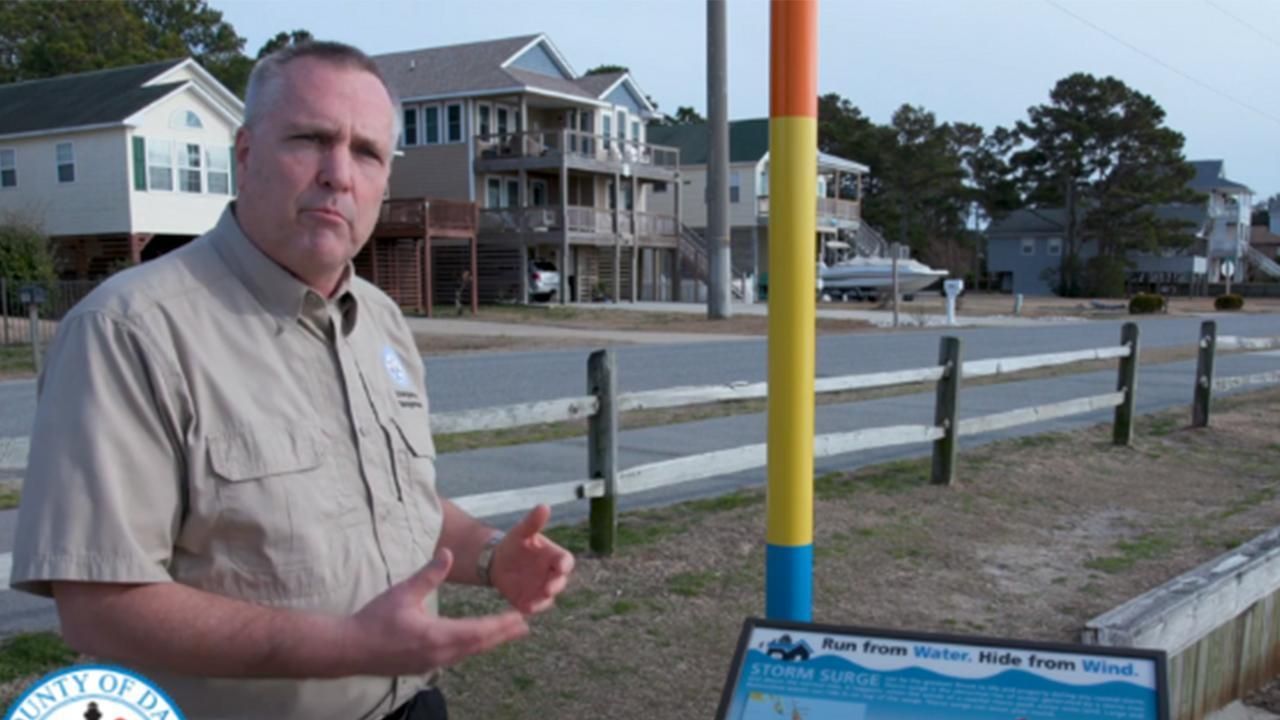
Drew Pearson, Dare County's emergency management director, partnered with the NHC to install educational displays and signage around the Outer Banks.
Brightly colored poles have been placed at 27 locations around the Outer Banks, from the Town of Duck to Hatteras Village, including at beach and sound access points, town halls and the ferry terminal.
Each color on the pole represents 3 feet of water above ground. A display beside each pole shows how the colors correspond with the NHC's flood inundation map
"Now when people hear there will be 1 to 3 feet of storm surge, they can see what that will look like and how severe it will be," said Pearson, who hopes the displays mean fewer water rescues, loss of property and especially loss of life in hurricane and severe weather events, adding, "I am truly hopeful that every resident, visitor and person who comes to the Outer Banks who sees one will know what they need to do when the storm surge forecast is issued to protect their lives and property."
Dare County also installed 12 new flood gauges, which will be used by North Carolina Emergency Management to update the statewide Flood Inundation Mapping and Alert Network, or FIMAN. Anyone can sign up to get FIMAN alerts regarding flooding in their area.
The flood gauges, installed on the sides of piers, monitor if water levels are rising or falling.
Dare County released a new video highlighting the changes.
The 2022 Atlantic Hurricane Season began June 1. Researchers expect 19 named storms and four major hurricanes to form in the north Atlantic from June to November as scientists say climate change is creating more powerful hurricanes.
Dr. Rick Luettich, the head of UNC’s Institute of Marine Sciences in Morehead City, said climate change has raised sea levels and made the water warmer, making flooding more prevalent and allowing hurricanes to form and strengthen faster.
Luettich also told WRAL News that climate change has started to affect the way hurricanes behave. Recent data showed on average, hurricanes have been getting slower and wetter.

That means storms are sitting longer over the areas in their path, doing more damage and sending more rain and dangerous storm surge into communities.
“What tends to cause the most damage, the most loss of life, and the hardest to recover from is the water,” Luettich said.


