New NC election maps expected to pass next week over objections from Democrats
North Carolina lawmakers began debating controversial new political district maps Thursday — boundaries that, if they become law, would likely give Republicans near-insurmountable leads in the state legislature and put more local Republicans in the halls of congress for years to come.
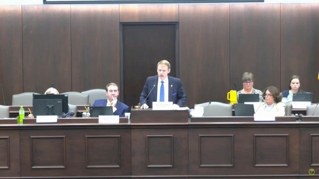
State House and Senate committees met Thursday to discuss, for the first time in public, proposed maps for the state's U.S. House of Representatives districts and for the state legislature. Republican lawmakers drew those maps in secret, a departure from recent years, and unveiled them Wednesday.
The GOP has a veto-proof supermajority in both legislative chambers now, but only by the bare minimum votes needed. The newly proposed maps would be expected to give Republicans more than 60% of the seats in each chamber — enough for a veto-proof supermajority — even if the GOP won just 50.5% of the statewide vote, data shows.
Republican leaders were not shy about hinting that politics played a role in their decisions.
"Political considerations are now allowed to be used," said Sen. Warren Daniel, R-Burke, who is a top mapmaker. "So it might be that that criteria explains some of the changes."
One of the Democrats on the losing end is North Raleigh Sen. Lisa Grafstein, the only openly LGBTQ member of the Senate. She has been a harsh critic of Republicans this year over new laws limiting transgender rights.
"Republicans drew me out of the district I represent, hoping to silence my voice," Grafstein wrote on social media Thursday, adding that she's exploring options for continued public service.
In addition to the legislative maps likely locking in GOP supermajorities, lawmakers are also considering two possible versions of a new Congressional map. The shape of the districts is different in each, but the result is the same: Making it nearly impossible for multiple Democratic representatives to win reelection, and thereby helping the national GOP in its efforts to hold onto control of the House.
North Carolina’s 14-member U.S. House delegation is evenly split 7-7 now; one of the proposed maps would all-but-guarantee an 11-3 split favoring Republicans while the other map has one competitive district, making it either a 10-4 or 11-3 split.
The maps could still be tweaked, but some version of them will likely be law by the end of next week. Once passed, they’ll be used in every election from 2024 to 2030 unless struck down in court first.
Once the maps pass, lawsuits are all but assured. The top Senate Democrat, Sen. Dan Blue, D-Wake, intimated Thursday that the congressional maps violate the Voting Rights Act. Each of the potential congressional maps could draw out one of North Carolina's three Black representatives, either U.S. Rep. Valerie Foushee, D-Orange, or U.S. Rep. Don Davis, D-Greene.
A top redistricting official, Sen. Ralph Hise, R-Mitchell, said he and his fellow Republicans didn't use racial data when drawing the maps.
Debate over legislative maps
Democrats sharply questioned Republican lawmakers on why they made certain decisions on the state legislative maps. At times GOP leaders declined to answer, saying their attorneys have advised them not to talk too much about their actions since they'll probably be sued once the maps become law.
"We're taking the advice of our legal counsel" to not answer certain questions, Daniel told Sen. Natasha Marcus, D-Mecklenburg, when she asked about records GOP leaders created while working on the maps.
A new state law, created as part of the state budget, exempts redistricting materials from public record laws.
In addition to being tight-lipped in explaining their own decisions, GOP leaders said they also don't plan to allow the public to comment on the maps before passing them into law.
Written comments can still be submitted to the legislature, Hise said, but there are no plans for another public hearing. Lawmakers previously held three hearings around the state — but there were no maps to comment on at the time.
"Very little of the comment from those hearings had anything to do with the districts," Hise said.
Marcus said that’s why they should have more public hearings now: "It's very hard to comment on maps that don't exist," she told Hise.
House members also met Thursday to discuss their own state House map, which lays out lines for their 120 districts. The meeting focused not on the map but on procedure, and House Redistricting Chairman Destin Hall, R-Caldwell, told members that:
- An Ohio consultant named Blake Springhetti drew this map, with input from Republican lawmakers. He was not involved in the congressional or state Senate maps, which the Senate has handled thus far. Springhetti "relied heavily" on data from past elections to draw state House districts, a common procedure that helps mapmakers predict the outcomes of elections and lock in power for one political party.
- Springhetti was told to ignore racial demographics in the draw, which opens the process to a potential Voting Rights Act challenge. The Southern Coalition for Social Justice, which has threatened litigation, has said U.S. Supreme Court precedent requires considering the impact new districts will have on minority voters.
- In-person public comment won't be accepted Monday and Tuesday when House committees meet to move these new maps forward, but an online comment portal will remain open.
Springhetti didn't immediately respond to a request for comment.
Hall pushed back against accusations that the maps proposed by the General Assembly's Republican majority would lock in supermajorities for the party, saying "that was not a goal at all in drawing these maps."
“There’s no goal to elect a certain number of members from one party over the other," Hall said.
Hall also made no promise that documents from the redistricting process would be preserved, saying lawmakers “will keep whatever records that they desire to keep," due to the new law exempting them from public records laws.
The Southern Coalition for Social Justice, which has sued over maps in the past, sent lawmakers a letter last week demanding that they preserve all redistricting records.
Analyzing the maps
Because Republicans hold veto-proof supermajorities in both chambers of the General Assembly, they are able to pass laws regardless of Democratic opposition. Under the proposed legislative maps, Republicans would likely continue to hold majorities in both chambers and could keep their supermajorities, but that analysis is more complex than reviewing the congressional maps.
House Democratic Leader Robert Reives noted that national-level politics often shift voting trends in local races. Reives, D-Chatham, said the proposed maps make it harder for Democrats to win back the legislature and that one "can’t say it’s a fair representation of North Carolina.”
Reives said he couldn't predict what final tallies would look like in future elections.
"A lot’s going to depend on, really, where the electorate is," he said. "We’re very polarized, but I believe that you do have parts of the electorate that are starting to get to a point where they’re just looking for a candidate, and they may be sick of the polarization.”
Republicans have held majorities in both legislative chambers since 2011.
Democrats and other left-leaning groups are expected to file lawsuits to block implementation of the new maps, but the legal landscape on redistricting in North Carolina has shifted in recent years to favor gerrymandering, the process of drawing maps to lock in political power by using past election results to predict how voters drawn into districts will vote in the future.
The shift was due in part to a 2019 U.S. Supreme Court decision. North Carolina voters also flipped the state Supreme Court last year from a Democratic majority to a Republican one. The new GOP court majority quickly overturned a 2022 precedent on partisan gerrymandering, favoring Republican efforts.
As the maps are analyzed, a number of themes are emerging, as are changes that will benefit particular politicians. Those include:
Cotham districts. The proposed maps shift the electoral calculus for state Rep. Tricia Cotham, who shook up the legislative session earlier this year by switching from the Democratic Party to the Republican Party, giving Republicans their narrow supermajority. Since then Republicans have a perfect record of overturning Democratic Gov. Roy Cooper's vetoes. Cotham would move from state House District 112 to House District 105 under the proposed legislative map, going from a reliably Democratic district to one split nearly evenly between Democrats and Republicans, based on 2022 election results. She’d also have a path to run for Congress in a new District 8 or District 9, depending on which of the two proposed maps is selected. Neither of those districts have an incumbent member living in them, other than U.S. Rep. Dan Bishop, who has said he’ll run for attorney general next year instead of reelection. Both districts lean heavily Republican.
Moore to Congress? The new maps also offer a path to Congress for Republican Speaker of the House Tim Moore, who has said he won’t run for re-election next year and has long been considered a likely congressional candidate. Moore could run in District 14 west of Charlotte, which includes his home in Cleveland county. In both proposals that new district voted more than 56% Republican during the 2022 U.S. Senate election.
County splits. The proposed congressional maps split major population centers. Sometimes that’s out of necessity. There’s no way to draw Wake and Mecklenburg counties, for example, without splitting the counties up. But the new congressional maps split up Wake and Mecklenburg — as well as other Democratic-leaning areas in or near Greensboro, Winston-Salem, Fayetteville, Rocky Mount and Asheville — more than is legally necessary.
Currently Greensboro and Winston-Salem are in a single district, represented by U.S. Rep. Kathy Manning, D-Greensboro. But one of the new maps would split up the Triad into three separate districts, all solidly Republican-leaning. The other map would split the Triad into four Republican-leaning districts.
Cumberland County is split in both congressional proposals, and in each case one of the Cumberland districts would run all the way to the coast, leaving critics to question how much Cumberland County voters have in common with voters in Dare County.
Likewise, one of the maps creates three districts in Wake County, one of which would be heavily Democratic and two others that would likely elect Republicans. One of those districts snakes from Wake Forest through multiple rural eastern North Carolina counties, ending at Morehead City on the coast. The other stretches from Garner and Holly Springs, through part of Chatham County, and into rural areas along the Virginia border stretching northwest of Greensboro.


