Coal ash dam failures would impact hundreds, maps show
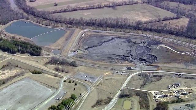
Maps released by Duke Energy late last week reveal for the first time that nearly 300 individual structures - homes, businesses and town infrastructure - could be in danger of flooding as a result of dam failures at the energy firm's coal ash pits scattered across the state.
Posted — Updated"These inundation maps really give an idea of what it would look like – at a minimum – if they were to fail into the river," Catawba Riverkeper Sam Perkins said.
No requirement for disclosure to residents
"When you buy a home, there are certain things that have to be disclosed," Perkins said. "But the threats these coal ash ponds pose are not a part of that."
Duke spokeswoman Erin Culbert said that, although the company changed course last month on its decision to release the information to the public, company officials share both emergency action plans and inundation maps with local and state regulators and emergency managers. They also meet face-to-face with public officials to plan for possible dam failures.
"Utilities like Duke provide the information to emergency management offices," Culbert said. "Those offices have the role to interface with the public. Generally speaking, Duke Energy would not be in position to make decisions about public protection steps."
The company's modeling shows that structures near half of the 14 coal plants across the state would see potential impacts if coal ash dams failed. That includes 88 buildings in Stokes and Rockingham counties near the Belew's Creek plant. Near the Asheville plant, 47 buildings are at risk.
Near the Allen and Marshall plants in the Charlotte area, 100 structures are listed in the inundation maps, with projected flooding ranging from less than an inch to 4 feet. They include properties on the shores of Lake Norman, where one worst-case scenario with both storm flooding and a dam breach would transform two peninsulas of homes into islands.
Perkins said maps of those two plants in particular show the impact of a dam failure would be much more serious than the 2014 coal ash spill in the rural area along the Dan River, an event that triggered a series of legislative actions to close the decades-old waste pits.
"Allen and Marshall are situated not just in populated areas, but in areas with some of the most booming growth," Perkins said.
Risk may lessen with cleanup
For some of the locations, Culbert said, there may be much less of a risk in reality than the maps show in the models. Although she said they're current as of the last three to five years, the company has begun to excavate or drain water from several ponds, removing some potential for flooding. Duke's current proposals to close the basins call for a "cap-in-place" solution for six of the 14 sites. The remainder will be dug up and the ash moved to lined pits elsewhere.
"Excavation is not necessary to relieve the possibility of inundation," Culbert said. "No matter how the company chooses to close a basin, all the ash basins will have the liquid removed."
But environmental advocates like Perkins – who has pushed the company to excavate all of the ponds and relocate the ash in lined ponds away from water sources – aren't convinced. With cap-in-place, Perkins said, floods from storms could still cause failure at the base of the dams, releasing toxic material into rivers.
That's also the position of the Southern Environmental Law Center, which represents Perkins and other groups that threatened to sue two weeks ago to force Duke to produce un-redacted versions of the inundation maps and their accompanying emergency action plans. The energy giant was the only public utility in the country that refused to release the information, required under the U.S. Environmental Protection Agency's Coal Combustion Residuals Rule.
"Now we know what Duke Energy was trying to hide. Duke Energy’s dangerous coal ash lagoons threaten families, houses, property, lakes and rivers throughout North Carolina if they fail," Frank Holleman, senior attorney at the SELC, said in a statement. "A wall of coal ash and polluted water could pour out of lagoons into neighborhoods and water supplies, flooding houses, businesses, roads and highways. Duke Energy should not impose these risks upon families and clean water."
The battle over these maps has a long history for the company in North Carolina.
That changed with the EPA's 2015 coal ash rule.
It required coal ash pond operators to post emergency action plans online for dams considered "high-hazard" – those that would result in loss of life or serious harm to environment. Although the company posted redacted versions of its emergency action plans earlier this year that did not include inundation maps, Culbert said the threat of a suit by environmental advocates was "an important signal to us that there were folks who were interested in the information."
"We recognized a couple of weeks ago we had to change course because there is a specific requirement," she said.
Related Topics
• Credits
Copyright 2024 by Capitol Broadcasting Company. All rights reserved. This material may not be published, broadcast, rewritten or redistributed.


